As an Amazon Associate, I earn commission from qualifying purchases.
The Coastal Route of the Portuguese Camino takes you from Porto to Santiago de Compostela. Although the official route of the Camino Portugués starts in Lisbon, many pilgrims choose to start in Porto instead.
In Porto, pilgrims choose one of three route options to walk. They can walk inland on the Central Route or follow the coastal path on the Portuguese Coastal Camino. Some pilgrims walk to Santiago on the Senda Litoral which follows the coastline more closely.
On the Coastal Route to Santiago de Compostela, pilgrims can expect beautiful coastal scenery and charming small villages on the Atlantic coast. However, every now and then, the Coastal Route heads inland for a few miles, where the elevation gives you stunning coastal views.
The Coastal Route is the most varied of these three. After the stages in Portugal, the Camino heads inland, where pilgrims walk through the beautiful forests and hills of Galicia.
In this detailed guide, I’ll share with you:
- A clear overview of what awaits pilgrims on the Coastal Route
- Google Maps for the entire route plus (every individual stage)
- Advice on if this route is right for you
- A detailed itinerary for each stage
Time to put on your shoes and gather your pack as the Camino is calling!
Coastal Route Quick Facts
Here are some quick facts about this route of the Camino Portugués starting from Porto:
- Length: 275 kilometers / 170.88 miles long
- Total elevation gain: 4,974 meters / 16,319 feet
- Total elevation loss: 4,781 meters / 15,685 feet
- Popularity: Although the Central Route is more popular than the Coastal Route, things are changing fast. In fact, the Coastal Route is soon expected to become the most popular route.
Watch the route run from Porto to Santiago here:
The Portuguese Camino: Coastal Route vs Central Route
The Coastal Route of the Camino Portugués to Santiago de Compostela is just one of 3 route options through Portugal.
Where many pilgrims choose to follow the coast, other pilgrims prefer heading inland on the Central Route. Finally, the Senda Litoral caters to pilgrims who want to walk on nothing but beaches and boardwalks.
Here is how the Coastal Route compares to the Central Route at a glance:
- Difficulty: Cobblestones are one of the major difficulties of the Camino Portugués. While both routes have their fair share, the Central Route has significantly more stretches of them.
- Elevation: Although the Coastal Route follows the coastline, there is a little bit of elevation when it goes inland. However, it never reaches the level of the Central Route,e which makes this route a relatively easy walk that’s perfect for your first Camino.
- Landscape: The Coastal Route walks alongside the Portuguese coast, while the Central Route is walked through forests and rural landscapes.
- Towns: While the Coastal Route passes through some cute towns and villages, they don’t have the same level of charm as the ones on the Central Route.
- History: There is plenty of history to be found on the Coastal Route but you will find that not much is directly connected to the old pilgrimage. The Central Route is the older of the two and as a result, you will find more old pilgrims’ hostels and churches with direct links to the Camino de Santiago.
The Coastal Route is the best route for anyone looking to get the best of both worlds. In the first few days, pilgrims walk along the coast on boardwalks or boulevards. As you’re approaching Galicia, the road changes and pilgrims can expect forest walks and ancient towns with clear links to the Camino’s medieval past.
Eventually, all routes come together in Spain, in the town of Redondela. No matter how you choose to walk the Camino Portuguese, after Redondela, all pilgrims share the same road to Santiago.
Coastal Route Map
Although the complete route of the Portuguese Camino technically starts in Lisbon, most pilgrims will begin in Porto. This is where the Portuguese routes start and this is why we started our map here.
We started our map at the Camino marker in front of the Porto Cathedral (Se de Porto) and ends at the Santiago Cathedral. We walked the Camino route from Porto to Santiago by following the yellow arrows as much as possible.
There was one stage where we used the Camino Ninja app to follow the official Camino Route instead. At the Estela golf course on the stage to Esposende, we had to rely on the app rather than the yellow arrows to follow the official route.
We broke up the Camino Portugues Coastal Route into 12 stages but you can divide the route in many different ways. If you want to walk longer or shorter stages, then check out the posts on the individual stages where I go over some alternative stages.
Elevation
While elevation isn’t as big a thing on the Coastal Route as it is on the Central Route, there are still a few small hills to climb.
After leaving Porto, the Coastal Route is mainly flat for a few days but things change when you come closer to Spain. As the Coastal Route goes inland, elevation becomes a bigger part of the stages.
After leaving Viladesuso, you have to climb Monte Silleiro towards Baiona. This is the most significant climb of the Coastal Route.
What will you see on the Camino Portugues Coastal Route?
What’s in store for pilgrims who choose the Coastal way? Here’s a quick overview.
Along the Coast
Let’s start with the most obvious one, walking along the coast. The Coastal Route of the Portuguese Camino explores the coastal scenery of Northern Portugal.
If you choose not to head inland, On your coastal walk north, you’ll see:
- Boardwalks: You may have seen them in pictures and blogs. They start on day 2!
- Boulevards: The Coastal Route takes you through some of Portugal’s most popular destinations along the coast. In towns such as Póvoa de Varzim, this means beaches and boulevards.
- Beaches: Although the coastal scenery changes once you reach Spain, the Portuguese Coastal Route goes past some of the most beautiful beaches that Portugal has to offer.
- Historic Windmills: The old and weathered-looking mills along the coast are an important part of the coastal landscape.
For the first few days, the Coastal Route follows the coastline of the Atlantic Ocean. Pilgrims walk on boardwalks and boulevards as they make their way north to Esposende.
Rich History
While the Coastal Camino is much newer than the Central Route, the coastal landscape in Portugal and Spain has been inhabited for millennia. Sure, its history isn’t as intimately connected to medieval pilgrimage as the Central Route but it has plenty to offer history buffs!
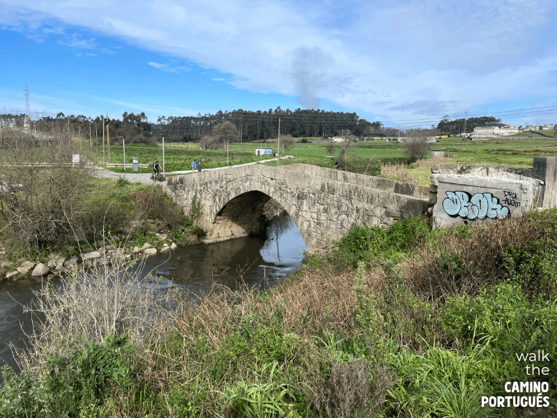
Besides the churches and forts connected to the Age of Exploration, pilgrims will come across ancient runes carved into the rock by Vikings, Neolithic fishing spots and Celtic hillforts, just to name a few.
Some of the highlights awaiting pilgrims on the Coastal Route:
- Roman roads: On the Coastal Route, you’ll come across Roman roads, salt pans and more.Did you know that Porto was already an important settlement in Roman times? It was called Portus Cale and this is where the name Portugal comes from!
- Stone Age settlements: The coastal landscape is old and the Coastal Route passes several ancient remains such as Castro de São Paio.
- Stone crosses: Although this is something that you’ll see more of as you get closer to Santiago, you will see the occasional stone cross along the way. In earlier times, stone crosses were used to mark the route to Santiago de Compostela and were believed to provide spiritual protection to pilgrims.
- Forst and Lighthouses: Portugal was a major power during the Age of Exploration and on the Coastal Route you will find forts, chapels and even replicas of ships that harken back to that time.
As you get closer to Spain, the history of the pilgrimage becomes increasingly visible. Churches are dedicated to Saint James, the road is lined with stone crosses and you’ll come across more and more interesting tidbits of pilgrim history on various plaques and signs.
Scroll through the photos below and read the captions for examples of all of these historical highlights:
Charming Fishing Villages
Although the Portuguese fishing industry has changed over the years, it is still very much alive. In some parts of Portugal, fishermen even use the same traditional techniques that have been around for generations. Seeing it up close and personal is one of the highlights of this route.
In places like Vila Cha or Ageiras, you’ll see rows of fishing boats pulled up on the beach as well as colorful shacks and houses that were once part of this industry. As a bonus, pilgrims who walk today can enjoy some of the freshest seafood of their lives!
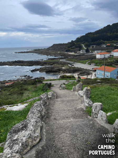
Some of my personal favorites are:
- Vila do Conde: Any time exploring this town is time well spent. Make sure you walk past the harbor and taste some fresh seafood at the Mercado Municipal.
- Esposende: Like many Portuguese towns, Esposende started as a fishing village. The town still celebrates its maritime roots during its annual São Tiago festival, where they celebrate the patron saint of fishermen.
- A Guarda: Built around a little harbor, the town of A Guarda in Spain has long been a fishing town. Fishermen here still bring home the catch of the day, which you can taste in one of the many seafood restaurants around town.
Read the captions on the photos below for examples of these towns:
The Coastal Camino Experience
For most pilgrims, the Camino is much more than just a beautiful walk along the coast. There is a certain ‘magic’ to it that sets walking a Camino apart from a hiking holiday.
Although the Portuguese Coastal Camino is relatively short when compared to the Camino Francés, it is long enough for you to fully experience what makes it so special.
Amenities
When you walk the Camino, you walk through inhabited parts of northern Portugal and Spain. This means that bars, restaurants, and supermarkets are often accessible to you. Portugal and Galicia both have a rich culinary scene and most towns are known for different dishes or wines. In addition to making walking the Camino a lot easier, pilgrims find that this adds a rich cultural element to their walk.

Albergues
Walking the Camino is a collective activity where you share the road with fellow pilgrims. Pilgrims often say that this feeling of community is formed in the albergues, or pilgrim hostels on the road. In the bunk beds and shared rooms, you meet so many pilgrims from all corners of the world that all share a common goal of making it to Santiago de Compostela.
While most towns have other accommodation options, such as hotels and guesthouses that offer private rooms, staying in albergues is worth a try. For many pilgrims, the chance meetings with fellow pilgrims become some of their most treasured memories.

Pilgrim Passport and Compostela
The crowning achievement of walking the Camino is collecting your Compostela, the official certificate you get for completing your pilgrimage. Not only does this serve as proof that you walked the Camino de Santiago, but it is also a great memento that many pilgrims choose to give a prominent place in their homes. Likewise, the pilgrim passport you use to collect stamps of all the places you eat or sleep at or just visit quickly becomes a souvenir of your own unique Camino.
Carrying Your Gear
While not everyone walks the same stages, putting on your pack in the morning is something that most pilgrims see as part of the Camino experience. Perfecting your pack and filling it with multi-purpose items is a fun way to get into your walk. When you’re packing and preparing for your pilgrimage, make sure to follow the golden rule that your pack cannot weigh more than 10% of your body weight.
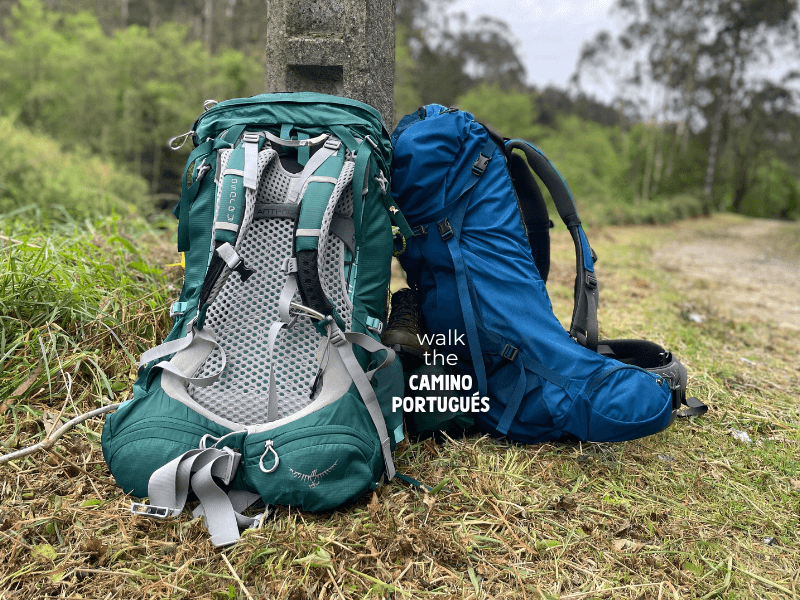
I have done the Camino several times and I share my personal pack as well as useful tips in my realistic packing list.
Luggage Transfer
If the idea of carrying all of your stuff on your back is stressing you out, don’t worry. Portugal and Spain both have a pretty robust network of luggage transfers. For just a few euros a day, someone comes by to collect your bag in the morning and it will be waiting for you by the time you arrive at your albergue. Especially on hot days or long stretches, carrying a day bag instead of your full pack can make all the difference!
Get a detailed guide here: Luggage Transfer Guide.
Stages of the Coastal Camino Route
There are many ways in which you can divide the long walk from Porto to Santiago. Some pilgrims choose to take their time and I’ve met people who walked 40km days!
The following itinerary is our preferred way to break up the distance:
- Day 1: Porto to Vila do Conde 28.4 km / 17.65 miles
- Day 2: Vila do Conde to Esposende 23.7 km / 14.73 miles
- Day 3: Esposende to Viana do Castelo 26.3 km / 16.34 miles
- Day 4: Viana do Castelo to Caminha 26.6 km / 16.53 miles
- Day 5: Caminha to Viladesuso 26.4 km / 16.40 miles
- Day 6: Viladesuso to A Ramallosa 19 km / 11.81 miles
- Day 7: A Ramallosa to Vigo 22.2 km / 13.79 miles
- Day 8: Vigo to Redondela 15.7 km / 9.76 miles
- Day 9: Redondela to Pontevedra 20.8 km / 12.9 miles
- Day 10: Pontevedra to Caldas de Reis 18.9 km / 11.7 miles
- Day 11: Caldas de Reis to Padrón 18.9 km / 11.7 miles
- Day 12: Padrón to Santiago 25.3 km / 15.7 miles
Keep in mind that this is the way we walked our Coastal Camino. We completely believe in the old saying that everyone has their own Camino and that however you plan your own way to Santiago is the right choice for you.
For each of the following stages, I suggest alternative stages with places to stay in the individual posts for that day. This way, you can easily plan to walk as little or as long as you want!
Day 1: Porto To Vila do Conde
Distance: 28.4 km / 17.65 miles
Elevation gained: 354 meters / 1,161.42 feet
Elevation lost: 404 meters / 1,325.46 feet
For a large part of the first day, pilgrims find themselves breaking free of the Porto bubble. To make matters even worse, you won’t see the coast until you reach the end of the stage!
However, this doesn’t mean that there’s nothing to be enjoyed. Porto (population 231,800) is part of the UNESCO World Heritage list and our route takes you past some of the highlights. In addition, the first day is probably the easiest as it has the most amenities of the entire Camino!

The official Camino marker outside of the Porto Cathedral 
The Porto Cathedral 
Bert-Jan walking the Porto Cathedral courtyard next to azulejo murals 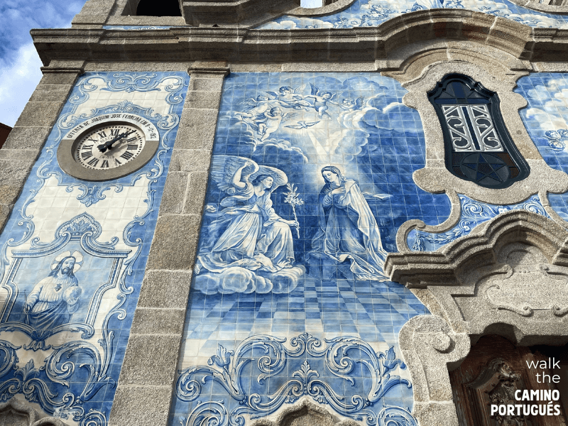
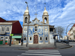
Up-close look at the azulejos on the Igreja do Sagrado Coração de Jesus in Porto 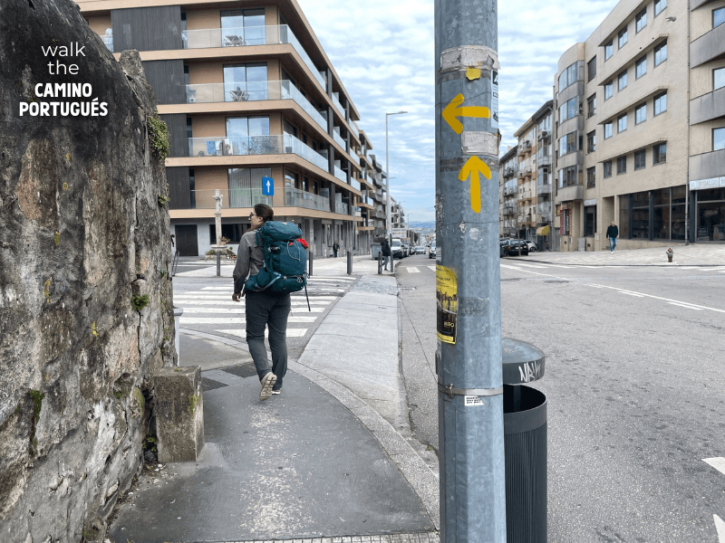
Pilgrim walking along the Camino Custóias (greater Porto area) where the Coastal Route splits from the Central Route 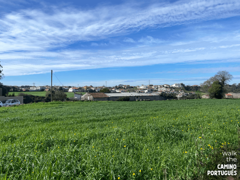
The Coastal Route opening up after leaving busy Porto behind 
Blue and white Portuguese decorative tiles 
The Igreja de São João Evangelista in Mindelo 
Blossoming tree along the Coastal Route 
The Igreja de Santa Maria de Azurara in Azurara near Vila do Conde 
Set of two red houses in traditional Portuguese style in Azurara along the Coastal Route 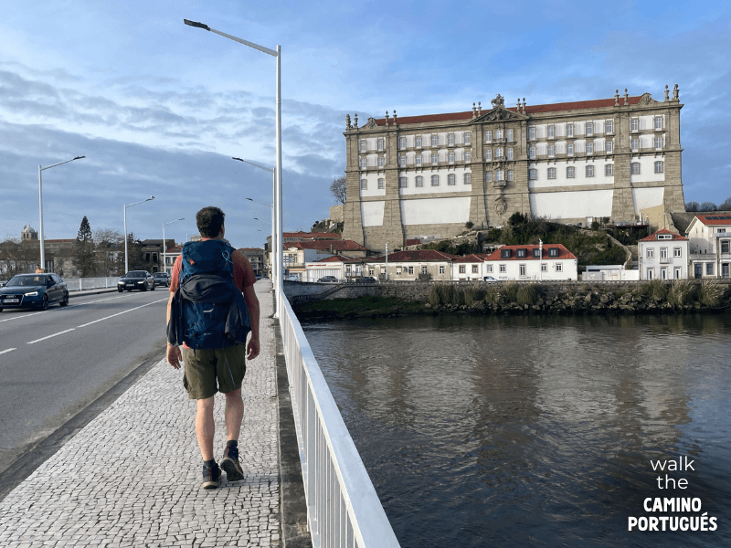
PIlgrim walking across the bridge into Vila do Conde with the Santa Clara monastery in the background 
The Santa Clara monastery at the entrance of Vila do Conde on the Camino Portugués 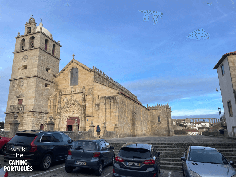
The Igreja Matriz de São João Baptista in the center of Vila do Conde on the Coastal Route of the Camino Portugués 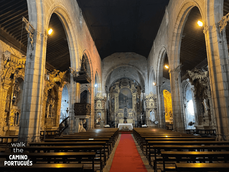
Interior of the Igreja Matriz de São João Baptista in Vila do Conde
I won’t lie, the first day on the Coastal Route is not the best. It’s not surprising that so many pilgrims choose to either follow the Senda Litoral along the Douro River or take the direct metro line to Vila do Conde or Póvoa de Varzim and start walking from there. You can find all the details in the post that covers this day.
Day 2: Vila do Conde to Esposende
Distance: 23.7 km / 14.73 miles
Elevation gained: 167 meters / 547.90 feet
Elevation lost: 170 meters / 557.74 feet
Your first day of boulevards, beaches and boardwalks! After a somewhat lacklustre first day, you finally get a taste of that coastal scenery that made you choose the Coastal Route in the first place.
The whole stage is well-marked and serves as the perfect introduction to the Coastal Route. Walking from Vila do Conde to Póvoa de Varzim means you have plenty of options for breakfast, coffee, or snacks and from there on it’s nothing but a scenic trail along the Portuguese coast.
Keep in mind that our map follows the official Coastal Route. This means that we don’t continue on the boardwalks at the Estela golf course. Instead, we join the M501 towards Esposende.

Azulejos scene along the Coastal Route of the Portuguese Camino 
Camino de Santiago sticker on the window of a restaurant along the Coastal Route 
Pilgrims walking on the beach in Póvoa de Varzim 
Small Camino sign nailed to the boardwalk out of Póvoa de Varzim on the Coastal Route of the Camino Portuguese 
Pilgrim sign painted on the side of a building outside of Póvoa de Varzim on the Coastal Route 
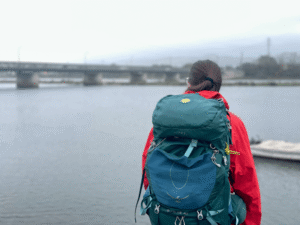
A pilgrim’s backpack on the wooden boardwalk on the Coastal Route 
Shrine to Saint James with pilgrim souvenirs on the Camino Portuguese 
Characteristic Portuguese church in Apúlia 
A Camino sign and a pilgrim who crosses the road 
A pilgrim standing in front of the Igreja do Senhor Bom Jesus de Fão on the Portuguese Camino da Costa 
A pilgrim admiring the interior of the Igreja do Senhor Bom Jesus de Fão 
A pilgrim looking at the Ponte metálico de Fão on the Coastal Way 
Statue of a Camino shell at the entrance of Esposende on the Coastal Camino
Day 3: Esposende to Viana do Castelo
Distance: 26.3 km / 16.34 miles
Elevation gained: 503 meters / 1,650.26 feet
Elevation lost: 499 meters / 1,637.80 feet
Today, the Camino visits the cute coastal town of Viana do Castelo (population 85,778), one of the highlights of the Coastal Route. On this stage, pilgrims move away from the coast and head inland to explore more of the coastal area of Portugal. While a large part of the day is spent walking on cobblestones, there are stretches of dirt paths that are a welcome change.
This is also the first stage where you’ll encounter some elevation and it’s a good illustration of how the Coastal Route is different from the Senda Litoral. Soon after leaving Esposende, the beautiful walk on beaches and windmills turns into a stunning forest walk that is one of my favorite sections in Portugal. As they gain altitude, pilgrims are rewarded with stunning views of the coastline.

Monument with hiking shoes along the Camino Portugués 
Statue of Saint James along the Portuguese Camino 
Church on the Coastal Route of the Camino Portuguese 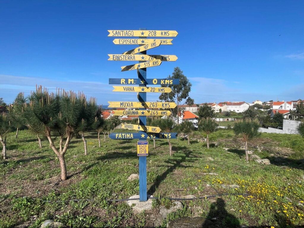
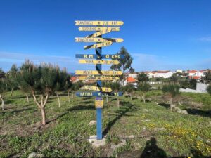
camino sign post Esposende To Viana Do Castelo 2-Coastal Route 
Image of Saint James made with painted tiles along the Camino Portuguese 
Cactus plants on the Camino Portuguese 
Yellow arrow painted on a rock in the forest along the Coastal Route 
Pilgrim walking on a forest trail on the Coastal Route of the Camino Portuguese 
The Ponte do Sebastião on the Coastal Route of the Camino Portuguese 
A statue of Saint James decorated with flowers before Easter 
Casa de Albinío, a pilgrim stand along the Coastal Route of the Camino Portugués 
Igreja e Mosteiro de São Romão do Neiva along the Coastal Route of the Camino Portugués 
Lemon tree next to the Portuguese Way 
Pilgrim climbing a slope on the Camino Portugués
Day 4: Viana do Castelo to Caminha
Distance: 26.6 km / 16.53 miles
Elevation gained: 609 meters / 1,998.69 feet
Elevation lost: 612 meters / 2,008.53 feet
Leaving Viana do Castelo can be a bit chaotic but the Camino soon becomes a tranquil walk on ancient roads and bridges. While the views of the Atlantic Ocean are sometimes obstructed by the stone walls that flank the route, there are plenty of moments here that you’ll remember for a long time.
There are a few nice stops on this stage. Places like Vila Praia de Ancora are great for lunch and if you go during spring the blooming flowers and trees can make places like the tiny town of Armada feel like a slice of paradise. Finally, Caminha (population 16,684), with its charming historic center, is the perfect place to enjoy a drink on the square and formally close the Portuguese section of the trail.

Pilgrims walking on stone paths between Viana do Castelo and Caminha on the Coastal Route of the Portuguese Camino 
Homes perched on the lush Portuguese hillside in Afife 
Views of the Atlantic Ocean over the eucalyptus trees in Afife 
A pilgrim walking through the lush forest wearing a backpack with a scallop shell hanging from the back 
An old, rusty Camino arrow sign in front of the Atlantic Ocean in Moldeo 
Lush purple flowers found along the Coastal Route of the Camino Portuguese 
Pilgrims walking next to the ocean alongside goats between Viana do Castelo and Caminha 
Goats grazing beside the Atlantic Ocean in Moldeo, Portugal
Day 5: Caminha to Viladesuso
Distance: 26.4 km / 16.40 miles
Elevation gained: 384 meters / 1,260.50 feet
Elevation lost: 369 meters / 1,210.63 feet
While some pilgrims choose to follow the river route to Valença, we decided to cross into Spain to get more of the coastline. Crossing the Minho River is easy, as the boat ride is short and the place where you buy your tickets is very well marked.
Once you’re in Spain, prepare for a coastal walk that is very different from Portugal. Beaches soon disappear and the coastline becomes more rugged and rocky. On this day, pilgrims walk past several of the most photographed places of the entire Camino; the beautiful beach and St James statue at Praia de Fedorento and the monastery at Oia.
Some pilgrims choose to stay at Oia because of its beauty and its location right next to the Atlantic coast. In my experience, it’s better to walk for a few extra kilometers to the town of Viladesuso where you can find significantly more accommodation options.

A pilgrim walking towards Fedorento beach outside A Guarda on the Coastal Route of the Camino Portugués 
Looking back at A Guarda and Fedorento beach on the Coastal Route 
Statue of Saint James on Fedorento beach on the Camino Portuguese Stairs going down to the coastline in A Guarda, Spain 
View of A Guarda and the rocky Spanish coastline on the Coastal Camino 
Fishing nets along the Spanish coastline 
Camino marker against a lush green backdrop on the Camino Portugués 
Eucalyptus leaves along the Camino Portugués 
Trees and palmtrees on the Coastal Route 
Small white flowers on a tree along the Camino Portuguese 
Pilgrim walking on the streets of Oia with the Royal Monastery of Santa María de Oia in the background 
The Royal Monastery of Santa María de Oia along the Coastal Route of the Camino Portugués 
Side wall with a little bridge and stream next to the Royal Monastery of Santa María de Oia on the Coastal Route 
Sunset from Viladesuso on the Coastal Route of the Camino Portugués
Day 6: Viladesuso to A Ramallosa
Distance: 19 km / 11.81 miles
Elevation gained: 363 meters / 1,190.55 feet
Elevation lost: 379 meters / 1,243.44 feet
This stage has some of the most breathtaking views of the Spanish coastline. While the Camino follows the coastline on a combination of paved roads and gravel paths, it all changes just before you get to the town of As Mariñas. The Camino sign is on the other side of the PO-552 (a busy road) and is easily missed!
After a steep climb with amazing views, the route becomes an especially scenic trail as it crosses the Monte Silleiro and enters the stunning coastal city of Baiona (population around 12,000). Some pilgrims choose to stay here for the night and I highly recommend taking some time to explore the beautifully preserved medieval center with its harbor and fort. On our route, we decided to keep going until A Ramallosa.

Pilgrim walking along the rocky Atlantic coast on the Coast Portuguese Camino 
Pilgrim climbing up the Monte Silleiro on the Coastal Route of the Camino Portugués 
The rocky coastline and the Atlantic Ocean near As Mariñas on the Coastal Route 
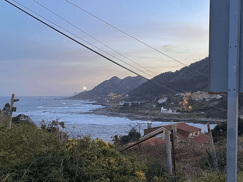
Spanish coastline on the Coastal Route with the Faro de Silleiro in the background 
Pilgrim climbing up the Monte Silleiro on the Coastal Route of the Camino Portugués 
The coastline and the Cíes Islands in the background on the Coastal Route 
The marina in Baiona on the Coastal Route taken through a white arch 
Medieval bridge in A Ramallosa on the Camino Portugués
Day 7: A Ramallosa to Vigo
Distance: 22.2 km / 13.80 miles
Elevation gained: 333 meters / 1,092.52 feet
Elevation lost: 315 meters / 1,033.86 feet
This stage starts on busy roads but soon takes you up into the hills and past some of the oldest historical landmarks on the entire Camino. The climb after A Ramallosa can feel strenuous but the views of the Cíes islands and the Ria de Vigo are stunning.
The Coastal Route skirts around most towns and instead takes you into the hills and forests of the surrounding countryside. On your way, you’ll walk past Bronze Age ruins and prehistoric burial sites which make for an interesting walk. While there is no escaping the Vigo (population 294,000) hub, the Camino does a great job of putting it off for as long as it can.
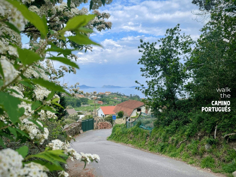
Winding street on the Coastal Route of the Camino Portugués with the Cíes Islands in the background 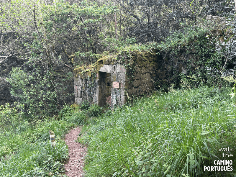
Ruins of an old watermill in Merendeiro San Miguel de Oia near Vigo on the Coastal Route of the Portuguese Camino de Santiago 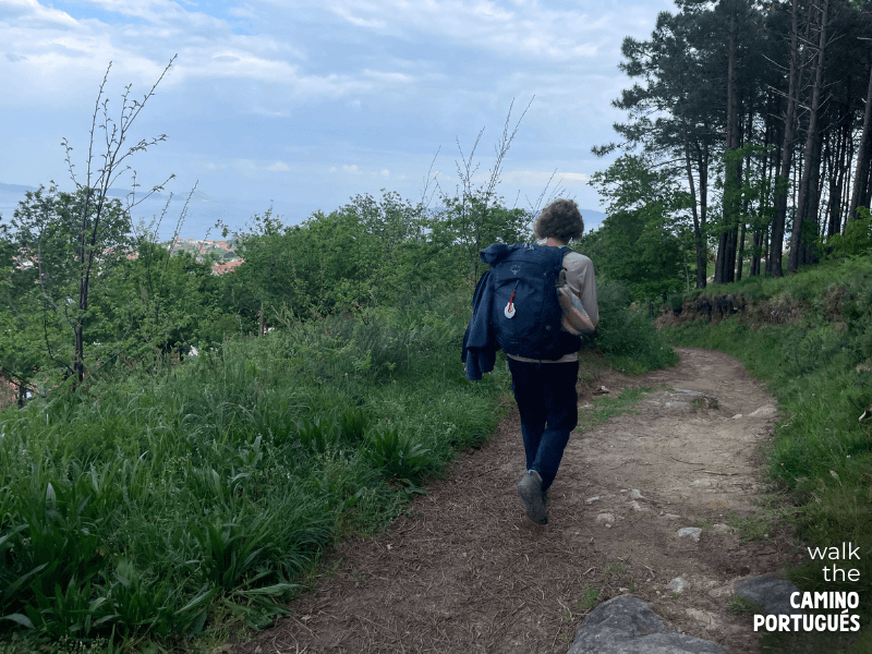
Pilgrim walking on a forest trail with Vigo in the background on the Camino Portugués 
Small waterfall in Merendeiro San Miguel de Oia near Vigo on the Coastal Route 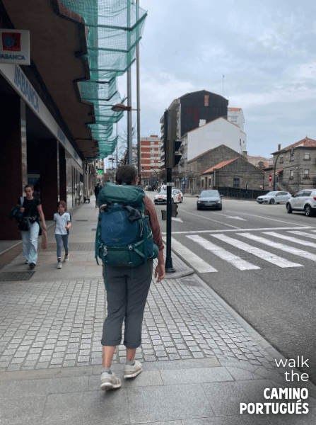
Pilgrim walking on a busy street in Vigo on the Portuguese Camino da Costa
Day 8: Vigo to Redondela
Distance: 15.6 km / 9.70 miles
Elevation gained: 345 meters / 1,131.89 feet
Elevation lost: 363 meters / 1,190.55 feet
This stage is a short walk that is one of my favorite stages on the Camino. After a bit of a chaotic start, the stage takes you on a climb that feels a lot harder than it is. As you make your way past little streams and waterfalls, you are surrounded by beautiful vistas of the Vigo Estuary and the Rande Bridge.
You will also notice a significant uptake in the number of pilgrims on the road. With its international airport, Vigo is a popular starting point for pilgrims who only want to walk the last 100 kilometers to Santiago. After a nice and short walk, the stage ends with a rather steep descent into Redondela (population 29.192).

A pilgrim walking up a steep hill leaving Vigo 
Dirt path with two cyclists and purple flowers hanging over the wall on the Coastal Route out of Vigo 
Waterfall at Rego Fondón on the Coastal Route of the Camino Portugués 
View on the Coastal Route of the Vigo estuary with the Ponte de Rande in the background 
The Ponte de Rande and the Vigo estuary on the Coastal Route 
Looking down on Vigo and the Vigo estuary on the Coastal Route towards Redondela 
Group of pilgrims in lush green path on the Coastal Route of the Camino Portuguese
Day 9: Redondela to Pontevedra
Distance: 20.8 km / 12.92 miles
Elevation gained: 527 meters / 1,728.35 feet
Elevation lost: 513 meters / 1,683.06 feet
This is another beautiful walk along the Vigo Estuary to the pilgrim town of Pontevedra. There are two hills to climb, one in the beginning and the second one just past the halfway point of the day.
All through the day, pilgrims can enjoy beautiful coastal views as well as plenty of amenities along the way. With cultural gems like the small town of Arcade (population 2,200) and its medieval bridge, several beautiful churches and the historic town of Pontevedra (population 83,241) at the end, this day is a day that brings out the best the Camino has to offer.
Leave some time to explore Pontevedra as it has several sites that have a direct link to the history of the medieval pilgrimage to Santiago de Compostela.

Stone bridge in Redondela, Portugal 

16th century Church of Saint Baia de Mos 
Camino momentos left by pilgrims on the Portuguese Way between Redondela and Pontevedra 
Pilgrim bench sitting next to the Puente Sampayo Bridge between Redondela and Pontevedra on the Camino Portugués 
Bert-Jan walking through a mossy tunnel wearing a backpack between Redondela and Pontevedra on the Camino Portugués 
Camino de Santiago mural between Redondela and Pontevedra on the Camino Portugués
Day 10: Pontevedra to Caldas de Reis 20.8 km
Distance: 20.8 kilometers / 12.9 miles
Elevation gained: 527 meters / 1,729 feet
Elevation lost: 514 meters / 1,690 feet
Today is a slow and relaxing day where the Camino takes you on forest trails through peaceful small towns to the historic town of Caldas de Reis (population 9,860) known for its hot springs. As I was walking this stage, I was amazed by the amazing job the Camino does of keeping you away from the hustle and bustle of Spain.
Galicia is one of the wettest regions in Spain and this becomes visible in the lush green forests of today’s stage. The result is a pleasant walk where you have the option to visit a stunning waterfall at Parque Natural Ría Barosa. That is if you follow the main route to Santiago.
Today is also where some pilgrims break away from the main Camino Route and instead walk the Spiritual Variant of the Portuguese Camino. Although this alternative route adds a few stages to your Camino Route, its remote and beautiful nature is worth the extra time!

Golden scallop shell showing the way of the Camino in Pontevedra 
Saint James on a historic cross outside the Iglesia de Santa María de Alba on the Portuguese Camino de Santiago 
Pink flowers along the Camino de Santiago 
Camino de Santiago memorabilia along the Portuguese Way 
A moss-covered tree with a pilgrim walking on the Portuguese Camino de Santiago behind it 
Pilgrim’s hiking boots sitting on top of a Camino waymarker on the Camino Portugués 
Two backpacks sitting in front of waterfalls at the Parque Natural Ría Barosa 
Pilgrims walking together on the Portuguese Way between Pontevedra and Caldas de Reis 
The Igrexa de San Tomé Becket in Caldas de Reis
Day 11: Caldas de Reis to Padrón 18.9 km
Distance: 18.9 kilometers / 11.8 miles
Elevation gained: 380 meters / 1,247 feet
Elevation lost: 394 meters / 1,293 feet
One last day of tranquil green fields and forests before the pilgrimage comes to an end in Santiago. Today’s stage doesn’t have a lot of elevation and most of it is spent walking through agricultural fields and woodlands.
Awaiting pilgrims at the end of the day is the historic town of Padrón (population 8,386). Named after the rock where the boat that carried St. James’ remains docked, this town is steeped in the folklore and tradition surrounding the pilgrimage. The church and monastery are worth a visit if you have the time!
Since tomorrow is a rather long stage, some pilgrims choose to walk a little further to give themselves a shorter day into Santiago. Wherever you decide to end this stage, make sure to savor your last night as a pilgrim.

A Camino waymarker with the historic Church of Saint Marina of Carracedo in the background 
Camino de Santiago scallop shells hanging on a pilgrim boot outside of the Church of Saint Marina of Carracedo 
Bert-Jan walking through the lush forest along the Portuguese Camino path between Caldas de Reis and Padrón 
Muíños de Valga, a historic mill that acted as a gathering place for pilgrims on the Portuguese Way 
The historic Cruceiro de San Lázaro in Padrón 
Bert-Jan walking into Padrón with a yellow arrow in the foreground 
The historic Bridge of Saint James entering Padrón
Day 12: Padrón to Santiago de Compostela 25.3 km
Distance: 25.3 kilometers / 15.7 miles
Elevation gained: 625 meters / 2,047 feet
Elevation lost: 381 meters / 1,250 feet
The exciting last day of your pilgrimage! This day is long, and the slow but steady ascent into Santiago de Compostela (population 97,798) can feel like it never ends. But the sacred heart of the pilgrimage awaits pilgrims who push through!
After a nice and relaxing first part, pilgrims enter the outskirts of Santiago. Although it seems like you’re almost there, there’s actually still quite a way to go. The feeling of seeing the cathedral spires for the first time is a special moment that I can still picture from my first Camino.
Excitement builds as you get closer and the big pay-off at the end is nothing short of amazing. As you walk onto the Plaza del Obradoiro, you’ll see the square filled with fellow pilgrims who all share this beautiful moment. Some will cry tears of happiness but most will hang out on the square with a telling smile on their face.

Historic church in Padrón along The Way 
Iglesia de Santa María Magdalena in Santiago de Compostela 
Artwork of Saint James on houses along the final stage of the Camino Portugués 
The 14th-century stone cross “Cruceiro de Rúa de Francos” in A Coruña, placed here for pilgrims 
Bert-Jan walking down quiet streets beneath vineyards on the Camino Portugués towards Santiago 
Bert-Jan walking in a pilgrim lane on the Rúa do Beado on the outskirts of Santiago de Compostela 
Compostela certificate in front of the Santiago Cathedral 
Pilgrim passport full of stamps in front of the Santiago Cathedral
Arriving in Santiago de Compostela
The feeling of arriving in Santiago is hard to put into words. Most pilgrims will feel a combination of intense gratitude and joy, but also sadness that their Camino is over. Whatever your experience is like, be fully present for it because the first time is truly a once-in-a-lifetime event.
Learn more about planning your arrival in Santiago in my guide
Plaza del Obradoiro
Arriving on the square in front of St. James Cathedral is very special. There are few times in life when people are just happy, when there are endless hugs for everybody, and when people just soak up the bliss of the moment. This is one of them.
While it’s tempting to immediately get your Compostela certificate, don’t skip this moment. If you arrived early in the day, you’ll likely see the familiar faces of people you met on the road. On my first Camino, we saw several people arrive whom we had met on the road and we decided to have dinner together one last time. Six pilgrimages later, this is still the one I remember most fondly.

Go to the Pilgrim Office to Collect Your Compostela
Once you feel like you’re ready, it’s time to get your Compostela, your pilgrim’s certificate that serves as proof of your achievement.
The process is very straightforward. You walk for 3 more minutes to go to the Pilgrim’s Reception Office in Santiago. You’ll be greeted by helpful staff who make it super easy to get your certificate. Be aware that there may be a long line during peak season so leave yourself some time to collect your Compostela.
Attend Pilgrim’s Mass
Whether you’re a believer or not, attending Pilgrim’s Mass is a great way to formally mark the end of your Pilgrimage. Although there has been a slow decline in the number of religious pilgrims who make the pilgrimage, there’s no denying that spirituality is still an important part of the experience.

When you’re sitting inside the large cathedral, take a moment to reflect on the origin of the pilgrimage and the fact that you’re part of a larger movement. Since medieval times, people have been gathering their packs and walking to Santiago, often on the same roads that you walked on your pilgrimage.
Get tips for planning your visit to Pilgrims’ Mass in my guide
Camino Portugués Coastal Route FAQs
One of the hardest things about walking the Portuguese Camino is having to choose one of the three route options available to you.
Especially if you have to travel far to get to Portugal, it feels like you get one chance to get it right. The combination of coastal scenery, beautiful ocean views and cultural highlights makes the Coastal Route my favorite route.
Here are a few quick FAQs to help you see if it’s the best route for you too.
What is the Coastal Route of the Portuguese Camino de Santiago?
The Coastal Route is one of three pilgrim routes that go from Porto to Santiago de Compostela. As the name suggests, it follows the coast and explores the coastal landscapes of northern Portugal and Spain.
Where does the Coastal Route start?
Like all three of the routes, the Coastal Route starts in front of the Sé de Porto, the medieval cathedral in the heart of the city.
You can find the first Camino sign pointing you in the right direction in front of the cathedral on the little square in front of the main entrance.
How Long is the Coastal Way of the Camino Portugués?
The main route of the Coastal Camino is 274 kilometers / 170 miles long. Although there are a few possible detours on the way, most pilgrims take about 12 days to walk the whole route.
How Hard is the Camino Portugués Coastal Route?
When compared to the Central Route, the Coastal Route is easier since it doesn’t have any of its long stages or big climbs. Although there are some inclines and hills once you get to Galicia, it never comes close to Alto da Portela.
Pilgrims on the Coastal Route will find that the hardest part of the walk is the endless streets of cobblestones. These can do a real number on your feet and are the most common cause of foot problems.
The Coastal Route is a lot more flexible than the Central Route. Since the Portuguese coast is a popular tourist destination, pilgrims can find accommodation options almost anywhere. This makes it really easy to create a custom itinerary to accommodate your individual needs.
How is the Coastal Route Different From the Other Routes?
While the Coastal Route lacks some of the history of the Central Route, it offers a more interesting mix of scenery. Where the Senda Litoral follows the Atlantic coast more closely, pilgrims sometimes find the route a little monotonous after a few days. Likewise, the Central Route takes you through vineyards and forests but I found that you’ll have plenty of that in Galicia.
¡Buen Camino!
Will you heed the call of the Coastal Route? I would love to answer any questions you have in the comments!
And, no matter which route you choose: Buen Camino, pilgrim!!