As an Amazon Associate, I earn commission from qualifying purchases.
Even after several pilgrimages, the Portuguese Camino holds plenty of surprises. Walking from A Ramallosa to Vigo turned out to be one of my favorite stages of the Coastal Route!
While walking into Vigo is in no way particularly exciting, the Coastal Route is a very scenic walk before you get there. With stunning views of the Vigo estuary and plenty of lovely forest paths, today is a nice and varied stage.
Although the stage starts in urban A Ramallosa, it won’t be long before you leave town and find yourself back in the hills again. While there are no particularly steep descents or climbs on this stage, the elevation makes it feel more strenuous than yesterday’s stage.
A few kilometers into the stage, there is a fork in the road because there are two routes pilgrims can take to Vigo. The Freixo Detour is a lovely option for any pilgrims looking for some extra forest walking. No matter which route you choose, you’ll find both routes well-marked, and the yellow arrows are easy to spot.
Save it for later! ↓

Quick links:
- Coastal Route Overview
- Yesterday’s stage: Viladesuso to A Ramallosa
- Tomorrow’s stage: Vigo to Redondela
A Ramallosa To Vigo (Coastal) Overview
Experience Today’s Walk
☑ See beautiful views of the Cíes Islands when you leave Nigrán
☑ Taste fresh octopus (pulpo a la Gallega)
☑ Hear how far you’re removed from the distant traffic below
☑ Touch walls that were built thousands of years ago
☑ Smell the forest in the morning as you walk through the Saiáns National Park
Right off the bat, the stage from A Ramallosa to Vigo starts with a bit of a climb that sets the tone for the rest of the day. Although the ascent is long, it’s very doable if you take your time.
Soon, you’ll find yourself on a lovely forest path with plenty of nice views of the built-up areas below and the Miñho River. In the distance, you can see how the Mino River eventually turns into the Vigo estuary.
On your walk, you’ll notice that many historic buildings have signs explaining their historic significance. Knowing what you’re looking at always helps you appreciate it more, and I highly recommend reading them.
Although you’ll be in or near urban areas for most of the day, the gravel paths and the abundant green in the forest make this day feel significantly more outdoorsy than you would expect.
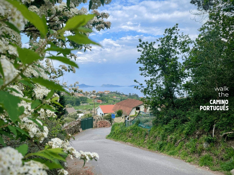
Winding street on the Coastal Route of the Camino Portugués with the Cíes Islands in the background 
Information sign on the Neotlithic settlements in Galicia near Vigo on the Coastal Route 
Information sign on the historic mills near Vigo on the Coastal Route 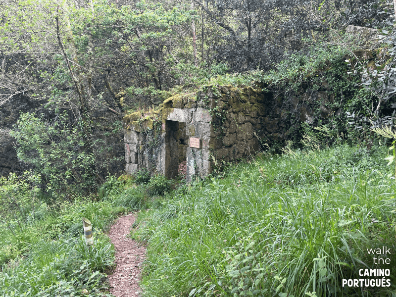
Ruins of an old watermill in Merendeiro San Miguel de Oia near Vigo on the Coastal Route of the Portuguese Camino de Santiago 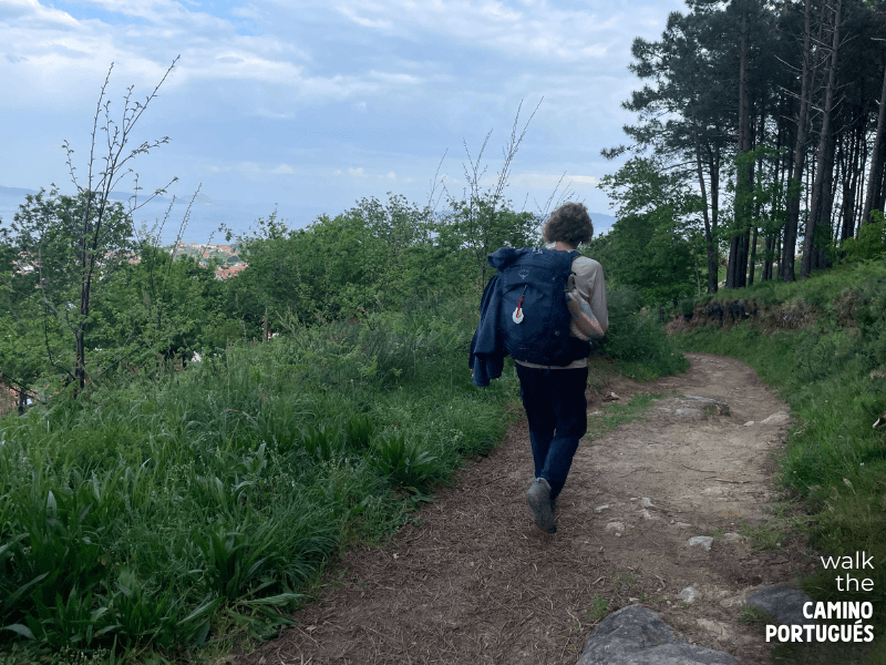
Pilgrim walking on a forest trail with Vigo in the background on the Camino Portugués 
Small waterfall in Merendeiro San Miguel de Oia near Vigo on the Coastal Route 
Pilgrim walking near billboards on the outskirts of Coruxo near Vigo on the Coastal Route 
Pilgrim walking through urban part of Vigo on the Coastal Route of the Camino Portugués 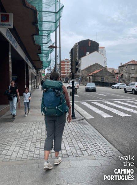
Pilgrim walking on a busy street in Vigo on the Portuguese Camino da Costa
Coastal Route or Senda Litoral?
Just like yesterday, the first choice of the day is which Camino Route to take. The moment of choice comes just after crossing the Roman bridge into A Ramallosa. You can either turn left towards the coast or turn right and go up into the hills.
Going left means you’ll follow the Senda Litoral. You will walk past beautiful beaches, coastal towns, and lovely coastal scenery on your way to Vigo. Highlights are the beaches, such as Praia América in A Ramallosa. On your walk past beaches and boulevards, you’ll have plenty of places stop for a drink.
My favorite option, however, is to take the inland route up into the hills. In my opinion, this choice offers a much more varied and beautiful walk to Vigo. Although it has more climbing than the Litoral, it’s a lovely walk that offers stunning views of the sea and Vigo estuary as well as historic buildings and remains.
Map
Our map starts at the historic bridge in A Ramallosa. When the Coastal Route turns right, we choose to ignore the Litoral and follow the yellow arrows to take the official route into the hills.
Likewise, I avoided the PO-552 by walking a short stretch through the forest before rejoining the now familiar road in Coruxo. While I didn’t do the full Freixo detour, I walked part of it to avoid the outskirts of Vigo a little longer.
Finally, our map ends at the Vigo Guixar station, close to the old town centre. This way, you’re all set up to walk the next stage to Redondela.
Distance and Elevation*
Distance: 22.2 km / 13.80 miles
Elevation gained: 333 meters / 1,092.52 feet
Elevation lost: 315 meters / 1,033.86 feet
*Distances are estimates. Learn why on our methodology page.
Amenities
Although you walk very close to towns for most of the day, amenities aren’t as abundant in this stage as they were in earlier ones. You won’t have any problems finding a place for breakfast or dinner, but the part in between is a different story. Speaking of breakfast, don’t skip the excellent O Cafeciño. It’s right on the Camino and serves excellent food and coffee.
Soon after you leave A Ramallosa, the Camino goes into the hills and takes you along the edge of towns rather than through the city centres. While you may stumble across the occasional places to stop for coffee, they’re not as common. It’s best to use them when you see them because it can be a while before you see the next one.
Once you approach the town of Coruxo, you start seeing panaderias and many bars and cafes again. I personally really liked the coffee and pastries (as well as the vibe) at Panaderia D’Casal. From here on, amenities are plentiful again.
Although Vigo has plenty of dinner options and even offers special pilgrim menus, I highly recommend trying the food at Bocatería L´squina. It’s cheap, it’s generous, it’s delicious. What more does a pilgrim need?
What’s In Store?
The walk from A Ramallosa to Vigo starts with a lovely walk through urban areas. After the Roman bridge, the Camino turns away from the sea and moves inland.
Although you start climbing after you leave Nigrán, it is very much a slow burn rather than a steep ascent. Take your time and go at a speed you’re comfortable with.
For most of the day, you walk higher up, and you’ll find yourself outside of urban areas. Although there’s a bit of climbing, I felt it really added variety to the stage. Making your way to Vigo, the path switches between surprising forests and beautiful coastal landscapes.
I personally found the last part of the stage a little disappointing. While the historic center of Vigo has plenty to offer, and it is a city worth visiting, the walk into town is nothing short of a slog.
Morning: Ancient Ruins and Priegue
From the Roman bridge in A Ramallosa, the camino takes you through a series of towns that very much look and feel like they’re connected. For example, it’s hard to say where A Ramallosa stops, and Nigrán or Priegue begins!
Soon you leave Priegue, and this is where this stage comes into its own. After a long but slow climb, you get your first views of the sea and the towns below. This gives you a very good indication of what you’re in for today.
This part of Spain has a long history of human occupation, and if you know where to look, you’ll notice many signs throughout the day. Keep an eye out for prehistoric petroglyphs, remains of old mills (molinos), and the small artificial-looking hills called Mamoas, ancient burial sites that are thousands of years old.
Historical fun fact: Although the Iron Age ruins in this area are very old, human presence in the region goes even further back. In the 1980s, archeologists discovered a cache of 27 axes from the Bronze Age, and some of the mills go back even further!
As a bit of a history buff, walking through the remains of Castro de Saiáns was one of my personal highlights of this stage. Here you walk past the ruins of an Iron Age settlement that goes back thousands of years. While you can’t see many intact structures, there are plenty of information signs that really help bring this ancient landscape to life.
And the best thing? Most pilgrims don’t come here, so you’re likely to have this all to yourself!
Afternoon: Forests and Coruxo
While the ‘prehistoric’ section of this morning is already quite foresty, the camino stays lush and green until it reaches the outskirts of Vigo.
After the lovely forests of the morning, the official Camino route continues to follow the PO-552, the main road to Vigo. If you’re like me and the prospect of walking next to a busy road doesn’t excite you, then follow our map.
Rather than walking to the main road, I turned right and walked east along the Camiño Esteriz. After a beautiful walk through some of the greenest and most remote forests I’ve seen on the Coastal Route, the route rejoins the Camino at the Igrexa de San Salvador de Coruxo, a small chapel in Coruxo.
Even though elevation remains a bit of a thing for this stretch, it’s not as severe as it was this morning. The trail goes up and down a little, but it never felt strenuous.
While I was walking, I met significantly fewer pilgrims than I did on the Senda Litoral. If you want some quiet time to reflect, this is clearly the way to go!
The Optional Freixo Detour
Just before you reach the town of Coruxo, you can choose to deviate from the official route by taking the Freixo detour. This alternative path takes you to the Albergue O Freixo before rejoining the Camino just before Parque de Castrelos in Vigo.
Instead of the familiar yellow arrows, the Freixo detour is marked by green arrows. If you do decide to walk this, prepare for a day with roughly 5 additional kilometers of steep climbs and beautiful scenery!
I was hungry and looking for coffee, so I decided to continue straight and enter Coruxo instead. For the GPS tracks and a detailed route description of the full detour, visit Gronze.
Arriving in Vigo
No matter which route you take, this stage ends with the boring walk into Vigo. As an important city in Spain, Vigo has a major port and all the industry that comes with it. While the old town is worth a visit, the outskirts offer little in terms of sights.
At first, Vigo doens’t look that bad. For a little while, you walk along the Sendeiro do Lagares, a lovely pedestrian walkway that follows the Lagares River. Soon, however, you’ll see that you have the river on one side, but ugly industry on the other. The walkway along the river ends at the Parque de Castrelos, a nice park from where you turn left into Vigo proper.
Although walking into Vigo is one of the worst parts of the Portuguese Coastal route, the city centre is quite nice. The beautiful Casco Vello (Galician for ‘old town’) has bags of charm and offers very beautiful views of the Ria de Vigo and the harbor. If you have the energy, the fort of Castelo do Castro offers even better views!
Cíes Islands
Many pilgrims choose to take a rest day in Vigo. While the charm of the old town is enough on its own, Vigo has another ace up its sleeve, the Cíes Islands.
There are three islands in total, and together they form a nature reserve. From Vigo, you can visit the islands and even sleep there if you’re interested. Since it is a natural reserve, you can only visit with a permit.
The Cíes Islands are home to some of the most beautiful beaches in Spain. With an almost Caribbean vibe, they are a popular spot for pilgrims and locals alike. Make sure to arrive early for the best spots!
Accommodation Options
When it comes to choosing a place to stay, Vigo has loads of options. As a major city, Vigo has places to stay for pilgrims of every budget.
If you’re traveling in off-season, I highly recommend the fancy-looking Hotel Bahía de Vigo. When Kayla and I stayed here, we got a private room with breathtaking views of the Vigo estuary for only a few euros more than two bunk beds in a dorm.
For the standard albergue experience, look no further than the Albergue del Peregrinos de Vigo. In this no-nonsense albergue, you get the usual mix of a kitchen, wifi, and bunk beds.
Many hostels and hotels in Vigo offer big discounts during the low season. If you’re looking for a break from the bunk beds, it’s worth seeing what hidden gems you can find!
Extending or Shortening the Stage
With almost 25 km, the stage from A Ramallosa to Vigo is long enough, and most pilgrims choose to end their stay here.
Consider the following options if you’re looking to walk a little less or have a shorter day tomorrow.
Shorter Stage: Albergue o Freixo
Taking the Freixo detour is a fun way to shorten the stage. Apart from the challenges of elevation, the detour is pretty easy to follow. This place
Located outside Vigo, the Albergue o Freixo is a typical albergue that will be instantly familiar to experienced pilgrims. In addition to bunk beds, it offers a well-equipped kitchen and laundry options to its guests.
From the albergue, it takes about an hour to walk to the Parque de Castrelos.
Longer Stage: Stay East of the Vigo Bus Station
Leaving Vigo isn’t particularly interesting, especially once you’re out of the old town. This is why some pilgrims choose to walk a little further and stay on the other side of town.
On my first Camino, I stayed at Hotel Solpor, which means a longer walk today but saves you time tomorrow! This place offers cheap double or triple rooms with private bathrooms.
Buen Camino
And just like that, the Portuguese Coastal Route to Santiago de Compostela is almost done. Tomorrow, you’re looking at the last stage of the Coastal Camino!
Fortunately, the Camino ends with a bang. The walk to the next destination, Redondela, is short but a lot of fun. Kayla and I still reminisce about the first time we walked that stage.
¡Buen Camino!